Kekova, over the stonework
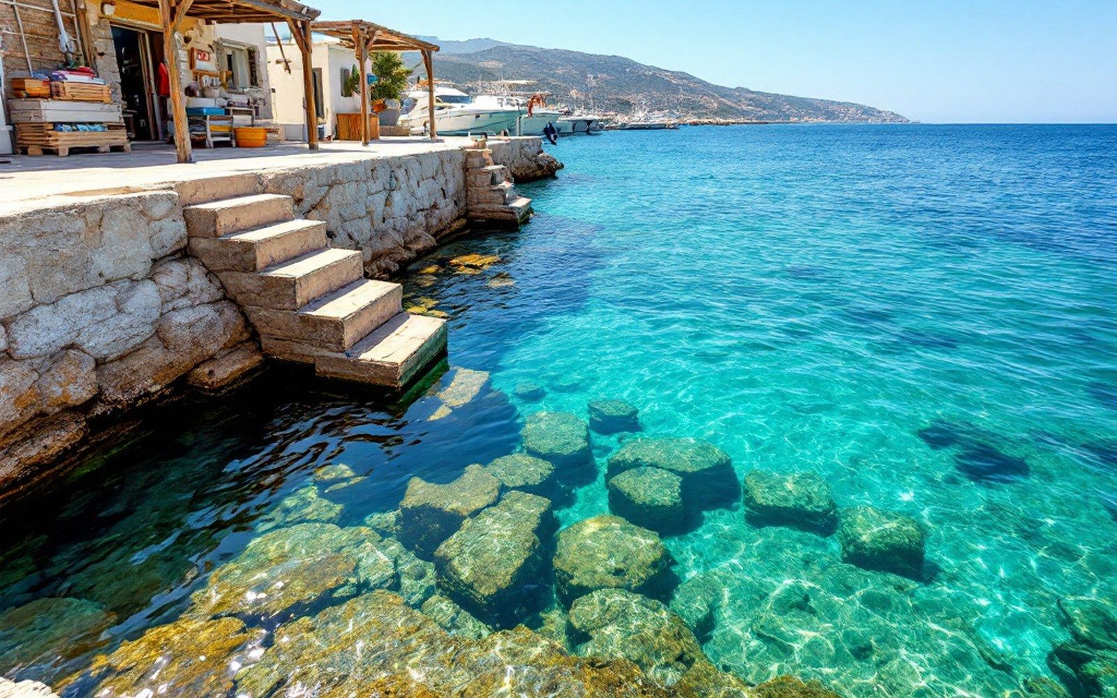
The water here is clear enough to make an argument about time. Below the hull, cut stone — doorways, threshold steps, the collar of a cistern — sits in two to four metres of Lycian calm, and the argument it makes is not romantic but geological: an earthquake in the second century AD dropped this coast perhaps two metres, and the sea moved in.
What sank, and why it stayed
The site is ancient Simena, or more precisely a cluster of small Lycian settlements — Simena, Teimioussa, Aperlae — strung along the island of Kekova and the opposing shoreline of the Kekova Roads, that shallow, reef-edged channel between the island and the mainland shore near Kaş. Lycian civilisation ↗ was not one city but a confederacy of towns, many of them small enough that their harbours were more quay than port, their public buildings more courtyard than forum. What remains above water at modern Simena is a small crusader castle — repaired by the Ottomans — and the rock-cut tombs that the Lycians preferred to any other monument: sarcophagi on high ground, lids shaped like the keels of upturned boats, because the Lycians believed the dead needed passage across water. What sank, in the subsidence event archaeologists associate with a mid-second-century earthquake sequence along this stretch of the Aegean-Anatolian margin, was the inhabited shoreline: walls, quays, cisterns, stairways. The sea covered them and then left them alone, because this part of the Turkish coast has no industrial trawling, no harbour dredging, no particular interest in the removal of submerged inconveniences. The stonework stayed where it fell.
Kekova is formally a Special Protected Area under Turkish legislation ↗, which means anchoring is restricted to marked zones, and diving — in the sense of entering the water with a mask and deliberately inspecting the ruins — is prohibited. The prohibition is enforced unevenly, as prohibitions on this coast tend to be, but it is real: the argument for it is straightforward. A diver with fins kicks silt; over a season, a hundred divers with fins kick enough silt to reduce visibility from four metres to a foot, and ruins viewed through a cloud of disturbed sediment are not ruins that are being preserved for anybody. The restriction costs the visitor nothing that matters: you can see everything from the boat.
Reading the water
Anchoring in the designated zones in the Kekova Roads, the visibility — on a calm morning before the meltemi finds its afternoon voice — is frequently good enough to identify what you are looking at without leaving the deck. The floors of rooms. The lip of a cistern. A threshold step, still approximately level, that once led from a street down to water that was not yet there. Some of the walls run in straight courses; others have collapsed into their own tumble of cut blocks. The scale is domestic rather than monumental, which helps: a doorway whose lintel is a metre and a half below the surface reads, immediately, as a doorway. You are not reconstructing ruins in your head; you are looking at them.
The western shore of Kekova island holds the densest run of submerged walls — the stretch sometimes called Batık Şehir, the Sunken City — and the standard approach is to drift slowly along it in a dinghy or from the bow of the gulet itself, reading the stonework below as the island's rocky spine passes alongside at deck height. A few of the rock-cut tombs on the island's upper shore were never submerged; their lids are still in the boat-keel form, and several still carry inscriptions in the Lycian script, an Indo-European language written in an alphabet derived from — but distinct from — Greek, and still not fully deciphered. The Turkish Ministry of Culture classifies the inscribed tombs as protected monuments; the classification is accurate, and the conservation problem is not vandalism but the sheer accessibility of the site: the island sits between two busy anchorages, and the traffic across a summer season is substantial.
Kaleköy and the economics of the anchorage
On the mainland shore directly opposite Kekova island, the village of Kaleköy — the modern name meaning simply Castle Village — sits beneath the Simena castle walls, a handful of houses and a cluster of small restaurants accessible only by boat or by a rough track from Üçağız inland. There is no road to the waterfront. That geographic fact, which preserved the village from the kind of development that arrived by tarmac along most of the rest of this coast, also preserved the character of the anchorage: a mixture of day-tripper boats from Kaş and Demre, overnight gulets on Blue Cruise itineraries, and the occasional private yacht working the passage between Fethiye and Kaş.
Kaleköy's restaurants run out a floating pontoon into the anchorage and take a stern-to mooring off it, which is the standard arrangement where a town quay is impractical or absent. The arrangement has a cost, built into the dinner price or charged separately as a mooring fee, and the fee has risen steadily over the seasons as the anchorage's reputation has consolidated. It remains, as of the early 2020s, significantly cheaper than a marina berth in Göcek or Kaş, but it is not the free anchorage it once was when fewer boats knew where Kekova was. The knowledge has spread; the prices have followed.
The site's archaeological status cuts the other way economically: because Kekova cannot be developed — no dock expansion, no resort, no fixed infrastructure — the volume of visitors is self-limiting in a way that the coast further west is not. There is a carrying capacity set not by planning authority but by physics: the Kekova Roads can hold a certain number of anchored hulls before the holding becomes competitive and the downstream effect on the ruins becomes measurable. In high summer, that number is routinely approached. It is also worth knowing that the submerged ruins are actively monitored ↗ by Turkish academic institutions, and the monitoring data informs, however slowly, the access rules that govern how many boats anchor where.
What the site offers, in exchange for the restrictions it imposes, is rare: archaeology at deck level, undisturbed enough that the geometry of the original town is still readable through water that is, on most mornings, cleaner than the air above it. The earthquake that dropped this coast was, on any human accounting, a disaster. Two thousand years of neglect did the rest, which is to say: the rest of the preservation.